File:ZOC, all locations by Aiibees.webp
Size of this PNG preview of this WEBP file: 651 × 599 pixels. Other resolution: 960 × 884 pixels.
Original file (960 × 884 pixels, file size: 137 KB, MIME type: image/webp)
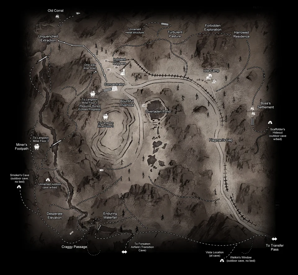
Map of the Zone of Contamination with All named locations, by Aiibees.
File history
Click on a date/time to view the file as it appeared at that time.
| Date/Time | Thumbnail | Dimensions | User | Comment | |
|---|---|---|---|---|---|
| current | 12:15, 21 April 2026 | | 960 × 884 (137 KB) | Maintenance script (talk | contribs) | == Summary == Importing file |
You cannot overwrite this file.
File usage
The following page uses this file: