File:Forlorn Muskeg map by whiteberry-toarda.jpg
Size of this preview: 558 × 600 pixels. Other resolution: 762 × 819 pixels.
Original file (762 × 819 pixels, file size: 112 KB, MIME type: image/jpeg)
Description
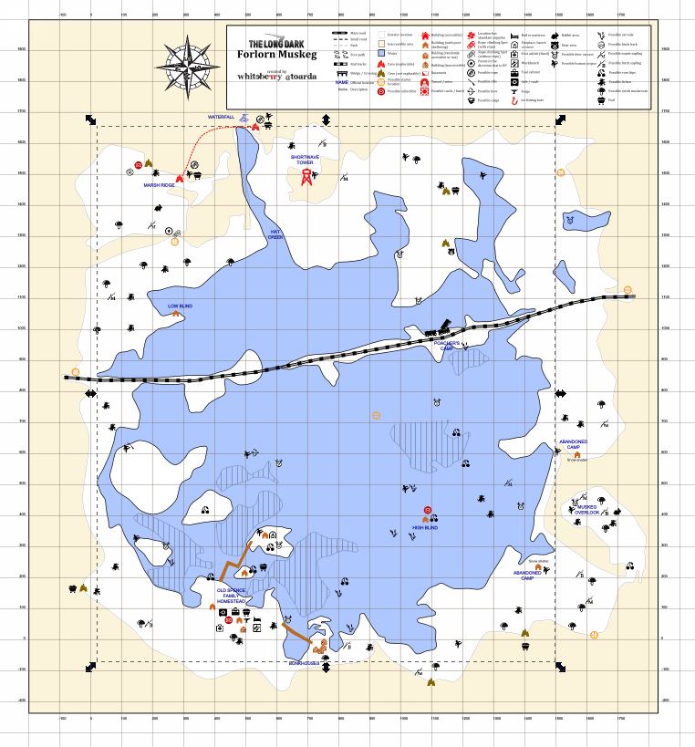
A connection to Milton Basin was added between the two caves on Marsh Ridge since this map was created.
File history
Click on a date/time to view the file as it appeared at that time.
| Date/Time | Thumbnail | Dimensions | User | Comment | |
|---|---|---|---|---|---|
| current | 12:10, 21 April 2026 | | 762 × 819 (112 KB) | Maintenance script (talk | contribs) | == Summary == Importing file |
You cannot overwrite this file.
File usage
There are no pages that use this file.